In the mining industry, the ability to accurately identify mineral deposits is essential for effective exploration and resource management. While significant advances have been made in geological exploration, challenges remain—particularly regarding the precision of mineral discovery. Abitibi Geophysics, a leader in geophysical exploration, is spearheading a groundbreaking project to enhance mineral exploration through a distributed induced polarization (IP) method connected via a mesh network.
Mining plays a vital role in global economic development by supplying raw materials essential to sectors such as manufacturing, energy, and technology. However, the exploration of new mineral deposits remains costly and uncertain. The gap between exploration expenses and successful discoveries has widened, driving the industry to seek more efficient and precise exploration methods.
Induced polarization is a geophysical technique that has shown strong potential in mining. It involves injecting an electrical charge into the ground and measuring the resulting voltage to detect mineral deposits. While effective, the current method requires significant labour and resources, limiting scalability and efficiency. Abitibi Geophysics’ innovative approach aims to automate this process, making it faster, more reliable, and more cost-effective.
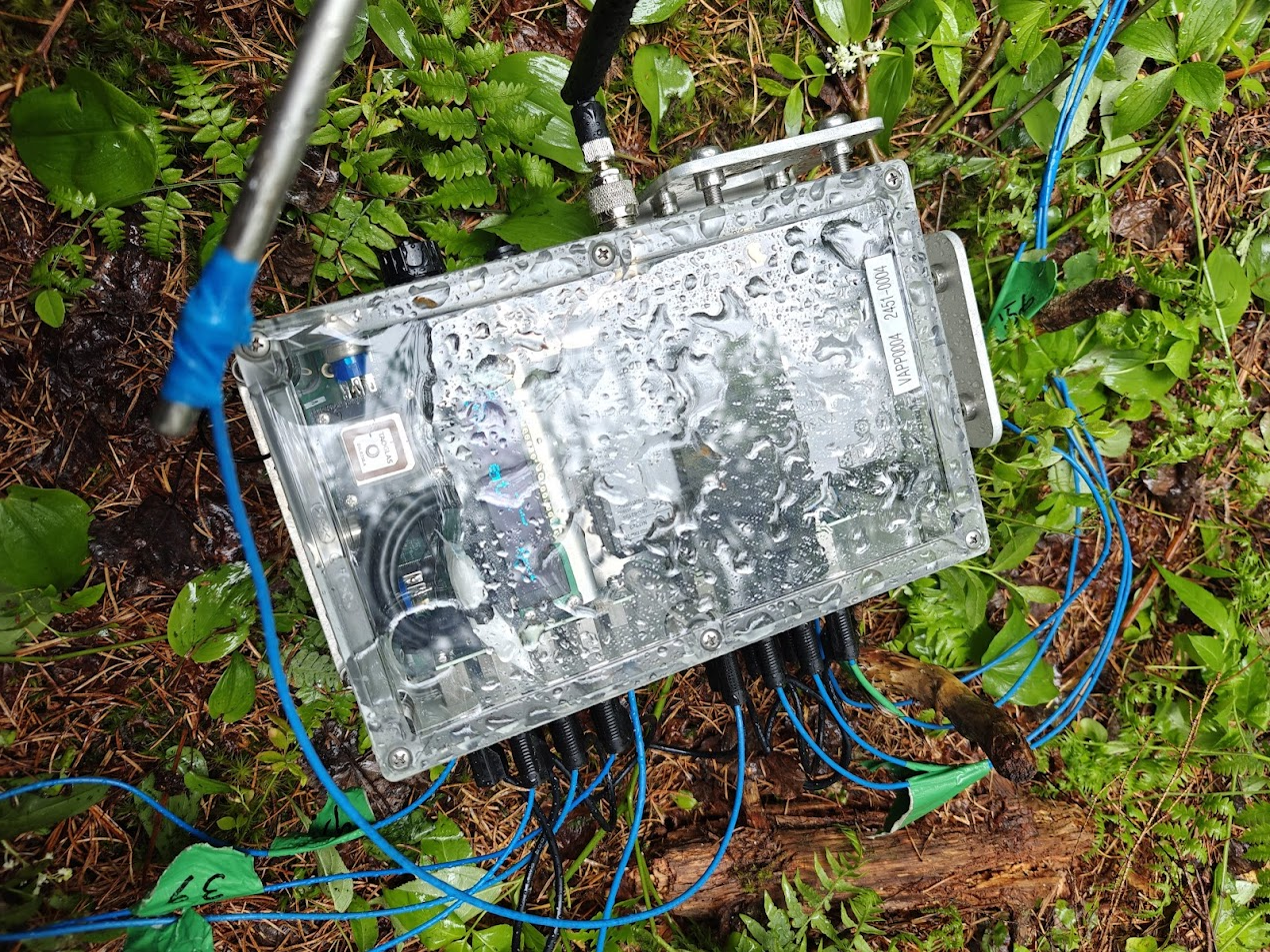
Developed under the Vortex program, this project focuses on creating an autonomous IP system. The goal is to improve the traditional method by developing a network of self-sufficient receivers capable of independently managing data collection, interpreting results, and communicating findings in real time. This approach is designed to increase the accuracy of field data and optimize exploration processes.
Autonomous Data Collection: The system will use self-operating receivers that gather data independently, eliminating manual retrieval and reducing human error.
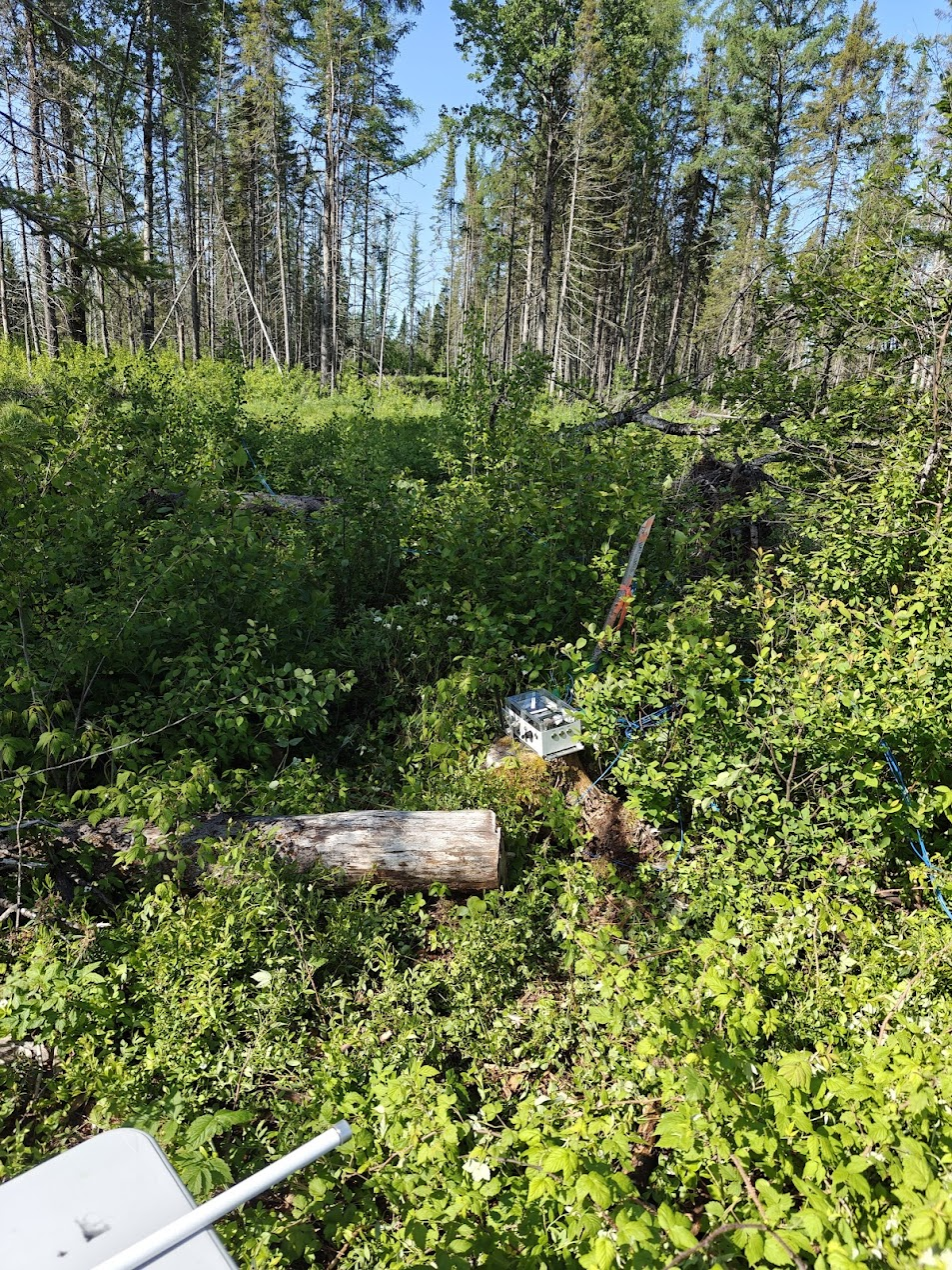
Wireless Mesh Network: Receivers will communicate with each other and transmit data through a mesh network, enabling smooth information flow across large geographic areas. This allows for real-time transmission without frequent physical intervention.
Advanced 3D Data Modelling: Collected data will be processed into 3D models for faster interpretation and analysis. This will allow geophysicists to visualize potential mineral deposits in three dimensions, increasing exploration accuracy.
Critical Mineral Detection: The system will be particularly effective for detecting critical metals and minerals, which are often more difficult to identify using traditional methods. This is increasingly important as demand for these minerals rises, especially in the technology and energy sectors.
Reduced Field Labour: With the system in place, technicians will no longer need to perform daily equipment checks, significantly reducing field time and labour requirements.
Real-Time Delivery of 3D Subsurface Models: At each current injection, between 160 and 400 readings are captured by the networked receivers and automatically sent to the control console. The console updates the 3D model in real time, allowing geologists to instantly visualize emerging targets. This major advantage offers two concrete benefits: immediate drilling of the best targets during the survey, and instant refinement of any unclear anomalies.
One of the main challenges of this project is integrating different devices into a unified network. Currently, IP equipment is not interconnected, requiring constant supervision and manual adjustments. The new system addresses this by embedding a mesh network, enabling automated communication across vast exploration sites.
In addition, the autonomous nature of the receivers requires them to independently maintain synchronization and power supply. This calls for the development of advanced energy solutions and GPS systems capable of operating in remote and challenging environments.
Abitibi Geophysics’ project is set to transform mineral exploration. By automating data collection and implementing advanced communication systems, the company will reduce the need for human intervention, improving efficiency while cutting costs. The scalable system can be deployed across large areas without compromising data quality.
This innovation will also enhance the accuracy of mineral identification, especially for critical metals essential to modern technologies. As the world transitions to a greener economy, demand for these resources is surging—making this project both timely and crucial for future mining operations.

The introduction of this autonomous induced polarization system reflects Abitibi Geophysics’ ongoing commitment to innovation. The company has consistently been at the forefront of developing new methodologies that benefit its clients and the mining community at large. This new approach demonstrates its forward-looking vision to advance geophysical exploration practices while adapting to the evolving needs of the mining industry.
Abitibi Geophysics’ distributed induced polarization project, powered by a mesh network, is set to revolutionize the mining sector. By automating data collection and analysis, this innovation will improve exploration efficiency, reduce costs, and deliver more precise results. Beyond enhancing the industry’s ability to discover new mineral deposits, it will play a key role in meeting the growing demand for critical minerals essential to modern technologies.
As the project advances, it will undoubtedly contribute to the future of sustainable and efficient mineral exploration.
– Until February 20, Corem and…
A reflection presented by MISA…


